
GTA 6 map guide: six confirmed Leonida regions explained
Explore the six officially presented Leonida regions, what Rockstar's material confirms, and why exact map size and routes remain unverified.
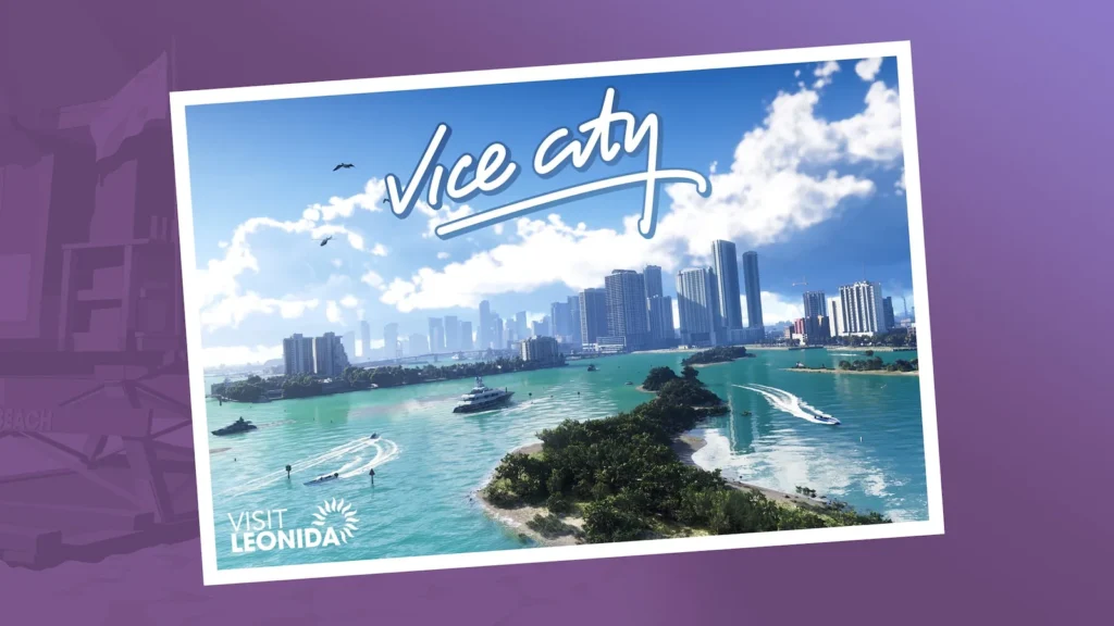
GTA 6 map guide: the official answer so far
The GTA 6 map guide begins with one important limit: Rockstar has presented Vice City and several destinations across the state of Leonida, but it has not published a complete navigational map with exact scale, road network, boundaries, or every playable settlement. Any fan-made outline is an interpretation until it can be compared with official mapping or the released game.
Rockstar’s “Only in Leonida” pages and media library are the primary references for named places. They establish a broad coastal state with dense urban areas, islands, wetlands, industrial communities, older resort zones, and a northern national-park region.
Where does GTA 6 take place?
GTA VI takes place across the fictional state of Leonida. Rockstar’s official pages present Vice City and five other major destinations—Leonida Keys, Grassrivers, Port Gellhorn, Ambrosia and Mount Kalaga National Park. The official story summary says the central conspiracy stretches across Leonida, but Rockstar has not defined the state’s complete playable boundary or said these six names are the entire map.
The six named Leonida regions
| Region or area | What Rockstar establishes |
|---|---|
| Vice City | The neon-soaked urban center in Rockstar’s current Leonida presentation. |
| Leonida Keys | An island-chain destination tied to Jason’s background and Brian Heder’s smuggling history. |
| Grassrivers | A wetland destination presented through waterways, wildlife and airboat imagery. |
| Port Gellhorn | A former vacation destination whose official profile emphasizes cheap motels, closed attractions and empty strip malls. |
| Ambrosia | An industrial community where Rockstar highlights Allied Crystal and local power. |
| Mount Kalaga National Park | A northern wilderness setting presented with rugged terrain, trails, water and wildlife. |
These are useful regional anchors, not a claim that Leonida contains only six places. Rockstar can reveal more named districts, towns, interiors, and points of interest before or after launch.
What we do not know about map size and routes
How big is the GTA 6 map?
Rockstar has not published an official total map size. Official screenshots and footage establish varied environments, but they cannot prove total playable area, travel time or a reliable size ratio against another Rockstar game. Exact square-mile or square-kilometer totals remain fan estimates until Rockstar publishes a measurement or the released game can be tested.
The same caution applies to boundaries. Water, bridges, highways, and skyline placement can suggest connections without revealing the final route available to the player. We therefore describe each location independently and avoid turning our schematic explorer into an “exact leaked map.”
How to use the GGWaypoint interactive map
Open Map & locations and select a waypoint to read a short verified summary and open its database record. The pin positions are deliberately illustrative. They organize the six official names for browsing; they are not coordinates and should not be used to judge scale or route planning.
After release, this GTA 6 map guide can evolve into tested navigation: road connections, useful landmarks, travel times, mission access, collectibles, and patch-sensitive changes. Each addition will distinguish direct play from official promotional information.
A practical way to read pre-release map claims
- Ask whether the place name appears on a Rockstar page.
- Separate a screenshot location from a complete map coordinate.
- Look for a method behind every size or travel-time claim.
- Check whether a fan project labels inference, leak material, and official facts separately.
- Return to the source when a new trailer or screenshot changes the interpretation.
We will also keep old versions when a map interpretation changes. A dated correction is more transparent than silently replacing a claim, especially when promotional material reveals a new road, district, or regional connection. The current schematic is designed to be revised without pretending that its pins were official coordinates.
Sources & verification
Checked 5 September 2026. Official sources support the factual details below; comparisons and recommendations are GGWaypoint editorial guidance.
Spotted a change? Send a correction.
Named places inside Vice City
Rockstar’s current Vice City presentation also names smaller world references including Ocean Beach, Tisha-Wocka Flea Market and VC Port. These records document Rockstar’s wording without assigning exact coordinates or boundaries that the official material has not published.